
Sub-Total: $0.00
Post
No Leap Too Great: Kate and Chicago River Revitalization

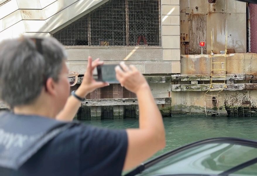
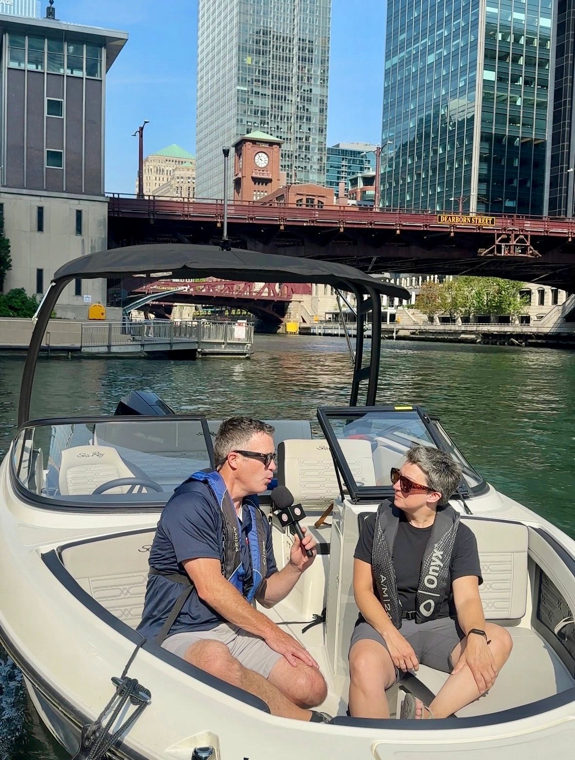
Kate’s story is a powerful example of how following your passion can lead to remarkable and unexpected paths with a profound impact on the world. A classically trained musician who spent two decades as a professional oboist, Kate’s journey took a fascinating turn when she volunteered with the McKinley Park Development Council as a way to find community during the COVID-19 pandemic. As she became more involved, her love for the outdoors and a personal safety scare in the Chicago Playpen led her to become a leading advocate for the revitalization of the Chicago River. Her work with the McKinley Park Development Council (MPDC) is not just about building bike paths; it’s about reconnecting communities to a natural resource that has been inaccessible for generations.
A Gap in the System Leads to a Groundbreaking Project
Kate’s (Kate Eakin) involvement with water safety began with a simple desire to cool off after a bike ride. She leaped into the lake next to a ladder, only to discover the rungs below the water’s surface were missing. This small but dangerous discovery revealed a much larger problem: there was no easy way for the public to report safety issues on Lake Michigan or the Chicago River. This gap in the system, coupled with the Chicago Harbor Safety Committee‘s shared concerns, focused Kate’s attention on water safety, and suddenly, there was a new purpose for MPDC’s crowdsourced form.
The crowdsourced mapping project is a cornerstone of the McKinley Park Development Council’s approach to revitalizing the Chicago River’s South Branch and the surrounding neighborhoods. Recognizing the need for detailed, on-the-ground information, Kate and her team developed a proactive strategy to gather data directly from the community. This initiative not only provides essential insights for infrastructure planning but also fosters community engagement and a sense of ownership over the project.
The Vision: A Car-Free Path Along the River
At the heart of MPDC Kate’s work is the South Branch Connectivity Project, an ambitious plan to create a continuous bike and pedestrian path along the river’s south branch. This project leverages the city’s River Design Guidelines, which require developers to build public infrastructure when they redevelop riverfront properties. The ultimate goal is to create a seamless, car-free route from the Richard J. Daley Boat Launch at Western Avenue to downtown Chicago. This project isn’t just about recreation; it’s about creating a safe, alternative transportation corridor that also brings the mental health benefits of being near water and green spaces to the public.
The timeline for this project is tied to market forces and development, but with sections already underway, the vision is becoming a reality. As more lots are sold and developed, each new section of the path will bring us closer to a fully connected riverfront.
More Than Just a Path: Fostering Community and Conservation
The project is about more than just infrastructure. Kate and her organization are working to foster a deeper connection between residents and the river. They’ve found that many people who have lived their entire lives on the Southwest Side of Chicago have never been to the river because it has been historically blocked off by industry. Through events and outreach, they’re working to change this, showing people that the river is a public space for everyone to enjoy.
Key initiatives include:
- Improving Access for Non-Motorized Craft: By expanding public access points and creating separate spaces for paddlers and fishers, they’re reducing conflicts and encouraging a wider range of activities on the water.
- Providing Paddle Craft Storage: Recognizing that not everyone can transport a kayak, they are exploring ideas for public storage options, like a simple shipping container shared storage, to make water sports more accessible to local residents.
- Encouraging Environmental Awareness: Kate also highlights the importance of protecting the river’s ecosystem. She points to the work of other nonprofits like URBAN RIVER, which has installed floating islands to restore habitats for beavers, otters, and various fish species. She also emphasizes the harmful effects of boat wakes, which cause erosion and destroy these fragile habitats.
Community as Cartographers: Documenting Existing Conditions
The original mapping endeavor began with a significant volunteer effort to inspect Chicago’s streets and sidewalks. Over the course of the previous fall, dedicated individuals walked approximately 500 city blocks across four key neighborhoods: McKinley Park, Pilsen, Bridgeport, and Chinatown. Their mission was to meticulously document the existing bike and pedestrian infrastructure and identify areas needing improvement. This wasn’t just a casual stroll; volunteers were equipped to record specific details, including:
- Broken sidewalks and uneven pavement: Highlighting tripping hazards and barriers to accessibility.
- Bike lane conditions: Noting the presence, quality, and any obstructions in existing bike lanes.
- Tree root damage: Identifying areas where tree roots have lifted or cracked sidewalks, posing challenges for pedestrians and cyclists.
- Accessibility issues: Documenting obstacles that would prevent wheelchair users or individuals with mobility challenges from navigating sidewalks.
- Trash accumulation: Identifying areas where litter is a persistent problem, negatively impacting the quality of public spaces.
Volunteers captured this information through photographs and precise location tagging, essentially creating a visual and spatial database of neighborhood conditions. This grassroots approach ensured that the data collected reflected the lived experiences and daily challenges faced by residents.
From Streets to the Shoreline: Expanding the Mapping Scope
Building on the success of the neighborhood infrastructure mapping, the McKinley Park Development Council is now applying the same principles and tools to the river’s edge. This expansion aims to create a comprehensive understanding of the current state of the riverfront, gathering critical data on:
- Ladder locations and conditions: Verifying the presence and usability of existing safety ladders along the river.
- Seawall integrity: Assessing the structural health of the seawalls and identifying areas needing repair.
- Debris in the water: Locating and documenting any hazardous materials or obstructions that could pose risks to boaters or wildlife.
Just as with the neighborhood mapping, the river edge study relies on geolocated photos, enabling the organization to create detailed maps that pinpoint specific issues. This visual and spatial data is invaluable for:
- Advocacy efforts: Providing concrete evidence of the need for safety improvements and infrastructure upgrades when engaging with city agencies and developers.
- Prioritizing intervention: Enables the organization to focus its resources on the most critical areas identified through the mapping process.
- Informing the signage plan: Understanding existing access points and potential hazards helps in strategically placing wayfinding and safety signage.
Navigating the Neighborhoods: Wayfinding and a Look to the Future
Looking ahead, the McKinley Park Development Council is collaborating with the National Park Service on a wayfinding and signage program. This plan will not only guide people to river access points but also direct them into local neighborhoods, highlighting businesses, cultural amenities such as the National Museum of Mexican Art, and parks. This initiative aims to benefit both residents, who will have a clearer understanding of their surroundings, and local businesses, by attracting new visitors and boosting tourism.
The partnership with the National Park Service (NPS) brings significant expertise to the mapping and planning process. While the NPS doesn’t provide direct funding, its technical assistance is proving invaluable. Their capabilities in GIS (Geographic Information Systems) work and mapping are enhancing the project in several ways. GIS involves using data layers overlaid on maps to analyze and visualize spatial information. For the riverfront project, the NPS’s GIS expertise allows the McKinley Park Development Council to:
- Organize and analyze the crowdsourced data: Integrating the photos and location data into a sophisticated mapping platform.
- Layer different types of information: Combining data on infrastructure conditions with property ownership information, permit history, and environmental data to create a comprehensive picture of the riverfront.
- Develop detailed maps for planning and advocacy: Produce high-quality visuals that clearly communicate the needs and opportunities along the river.
The partnership between the McKinley Park Development Council and the National Park Service highlights the power of combining local knowledge with expert technical skills to achieve impactful community development and transformation that benefits a city and its people for generations to come. Thank you to everyone involved in this effort.
Any boater on Chicago’s waterways can participate in the River Edge Condition study using the materials on MPDC’s website. And be sure to catch Boat Safe Chicago’s Captain Brady and Kate on INSTAGRAM this Thursday!
Would you like to donate to this heroic effort? Please visit the MPDC donation page HERE.